|
By John O’Connor ‘Navigate their way around the ha-ha, keep their distance from the ho-ho and completely ignore the he-he’ (Terry Pratchett – Snuff)
Before mechanical lawn mowers, a common way to keep large areas of grassland trimmed was to allow livestock to graze the grass. A ha-ha prevented grazing animals from gaining access to the lawn and gardens adjoining the house. Ha-ha ditches were commonly used in landscaped gardens and parks in the eighteenth century. They were built by digging a deep dry ditch where, in most cases, the inner side would be built up to the level of the surrounding turf with either a dry-stone or brick wall. The opposite side was designed to slope steeply upwards before levelling out again into turf. The ground was then levelled off to be the same height as the retaining wall, which resulted in the feature becoming less visible as the observer moved away from the ditch. This provided the viewer with a continuous vista, to create the illusion that the garden and landscape were one and undivided, whilst also providing a barrier to grazing livestock accessing the landscaped gardens. 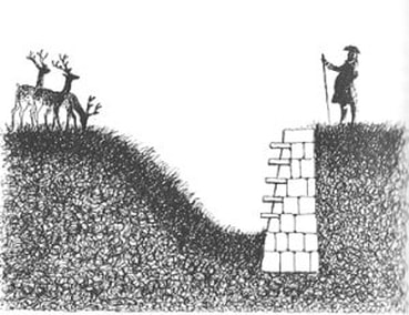 © Felix Kelly (sourced from https://austenonly.com/2010/11/28/the-ha-ha-all-you-wanted-to-know-but-were-afraid-to-ask/) The ha-ha in its current form is thought to have originated in late 17th or early 18th century France. They were certainly a part of French gardening practice by 1709, when the form was described by Dezallier d’Argenville in his book La Théorie et la Pratique du Jardinage, which was subsequently translated into English by the architect John James in 1712. According to d’Argenville the origin of the name ‘ha-ha’ came from the exclamation of surprise elicited from the unobservant visitor upon discovery. 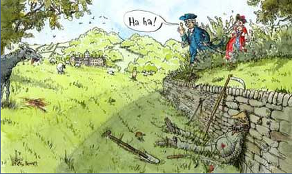 Sourced from http://www.bbc.co.uk/legacies/heritage/england/teesside/article_3.shtml The Dunkettle ha-ha consists of a revetted drystone wall, built into the almost vertical southern bank of a ditch with a gently sloping northern edge. The ground level to the south continues level with the top of the wall. In places this must have required the ground level to be raised, with material thrown up from the ditch excavation. The best-preserved stretches of the ha-ha exist beyond the project to the north, or in ground that was inaccessible for trenching due to dense mature woodland. 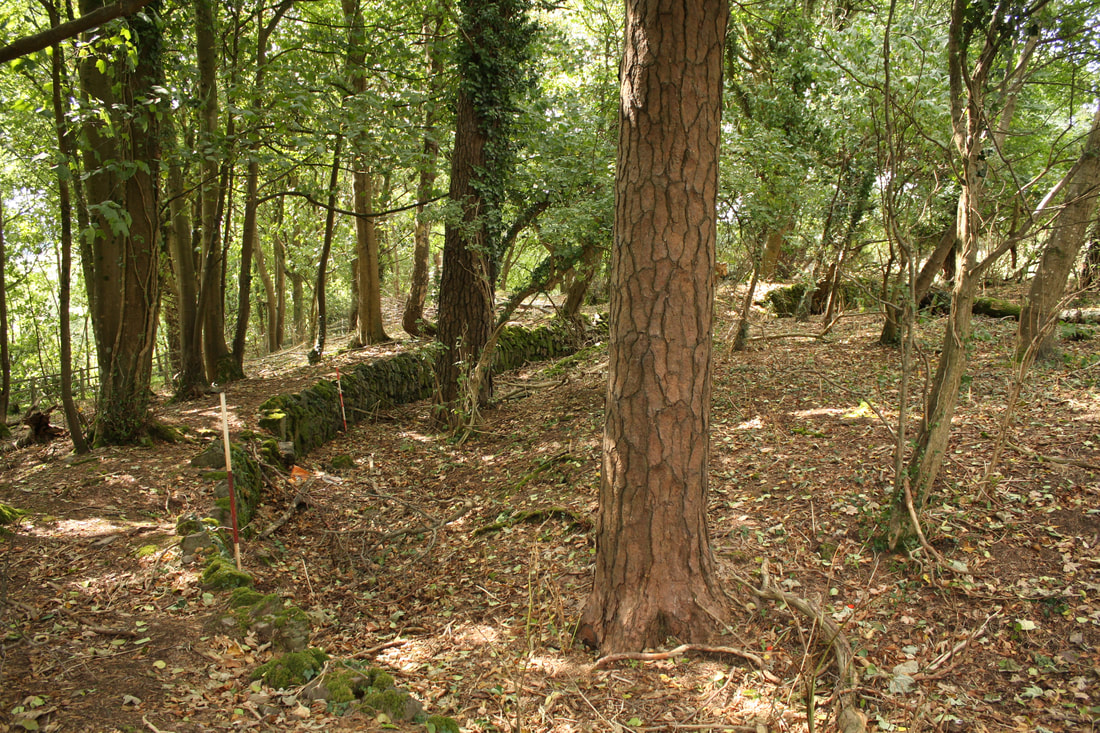 Curved portion of Dunkettle ha-ha, facing west 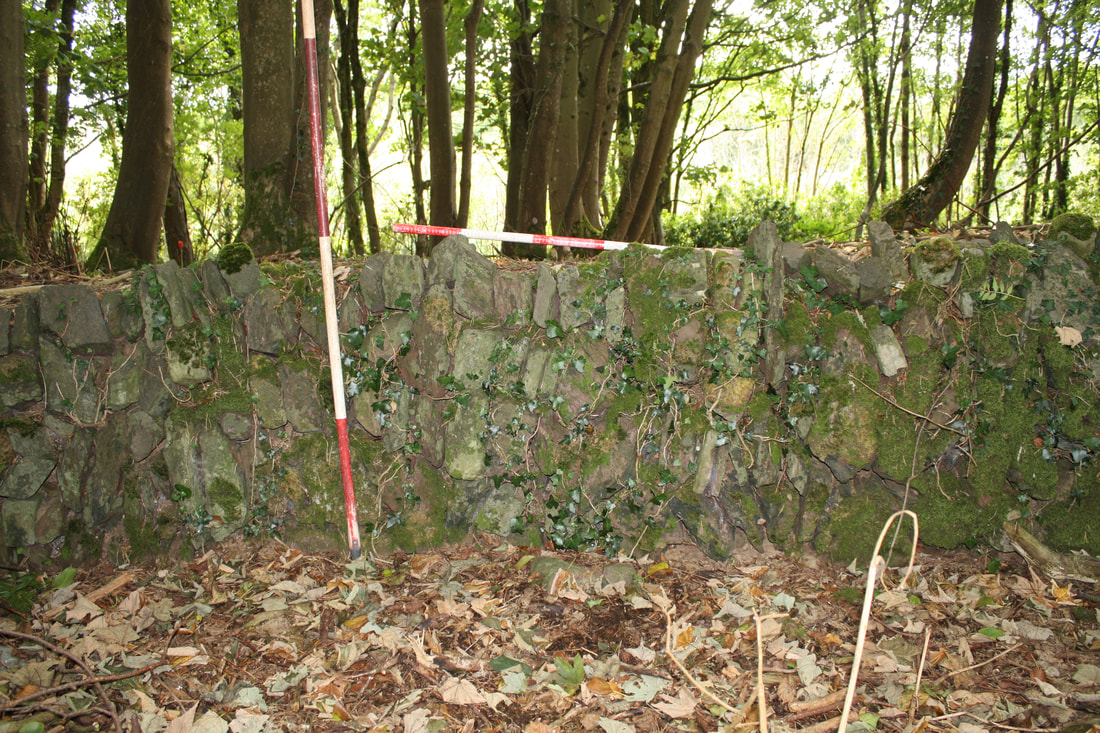 Stone revetment wall of Dunkettle Ha Ha, facing south The stone revetment is composed of uncoursed rough limestone with evidence of mortar bonding in places. The wall survives to a maximum height of 1.1 metres and has an average height of 0.8 metres. Further sections of wall foundations were discovered in the open ground to the east, but in poorer condition. One of these sections corresponds to a change in the boundary layout at this location, as evident in the difference between the 6” and 25” Ordnance Survey maps. 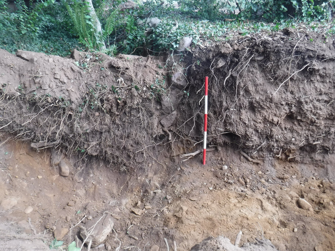 Section excavated through Ha Ha bank and wall, facing east 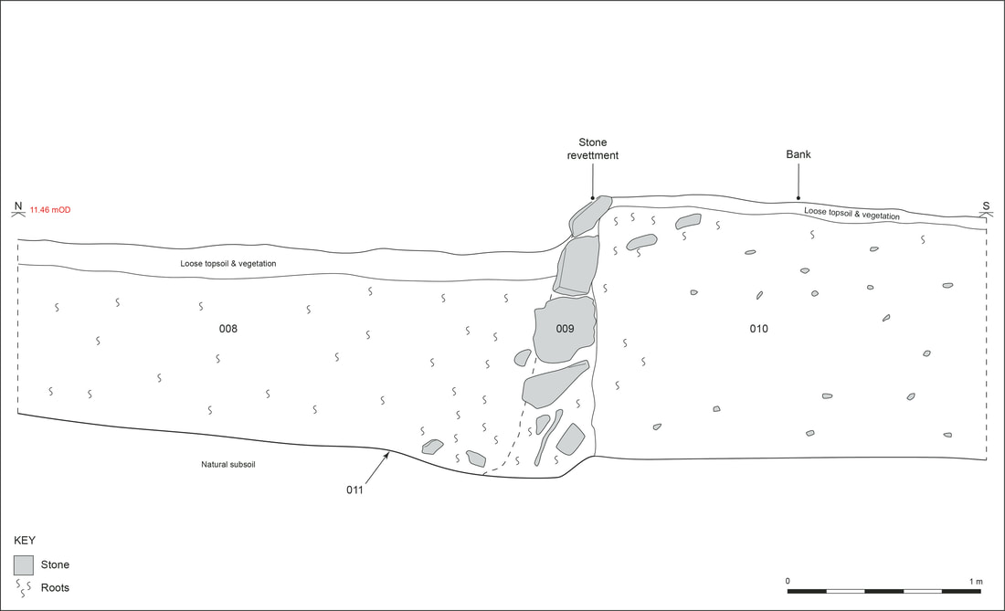 West-facing section through Ha Ha retaining wall (c 009) and bank (c 010) The route of the ha-ha is eccentric with the most irregular and interesting portion immediately parallel to the main façade of Dunkettle House, which is most likely an intentional element of the design. On the 1st Edition map the recorded section of ha-ha (Area 1) is marked as extending to the edge of an estate track, extending from east to west through the parkland to the north of the public road. Within the estate the feature would have been visible from both the south-east and south-west approaches to the house and likely served an aesthetic role, adding interest to the view from Dunkettle House and the southern approaches, whilst also providing a raised platform for tree-planting to mask the tidal mudflats of the bay and frame the broader vista of Cork Harbour. The ha-ha would have been invisible to anyone passing the estate on the public coastal road. Without access to Dunkettle house it is unclear whether the revetment wall itself was visible from the house or whether the alteration of the landscape hid the wall from view. During the project a second section of ha-ha (Area 2) was noted but not recorded in detail. 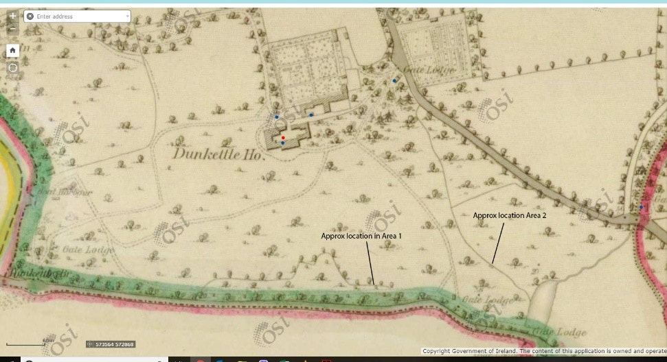 Extract from First Edition Ordnance Survey map, (c.1829-42) Initially, it was a matter of debate as to whether the Dunkettle ditch is actually a ha-ha. It appears to face the wrong way for a typical ha-ha, which kept animals from accessing the interior, and would have kept animals within the Demesne lands, rather than outside; more in keeping with the older deer-leaps than a traditional ha-ha (a deer-leap was a Norman feature that allowed deer to enter a park but not leave, and had its retaining wall on the outside face of the ditch, rather than the inside face). The reason for this reversal in construction may be two-fold; to prevent livestock from Dunkettle House escaping down to the road to the south, which laydown a very steep slope and directly alongside the estuary on the 1st edition 6” map, and to maintain an unrestricted view across the estuary from the house itself. While its visibility from Dunkettle House is not clear, what is clear is that it undoubtedly functioned as a physical boundary associated with the original construction of Dunkettle House, to inhibit the movement of stock or cattle across the landscape in some way.
The ha-ha appears to have been a relatively common feature of Irish country estates with fine examples located across the country. Although the ha-ha at Dunkettle is not accessible to the public those at Doneraile Park and Mallow Castle, both in County Cork, are. Other examples can be visited at Coole Park, and Portumna Castle, both in Co. Galway; Lough Rynn Castle Estate, Co. Leitrim and Malahide Castle, Co. Dublin to name but a few.
0 Comments
Your comment will be posted after it is approved.
Leave a Reply. |
This section will not be visible in live published website. Below are your current settings:
P: Contact Us
|
|