
|
By Teresa Bolger  The recently agreed programme for government includes various commitments to address climate change and increase biodiversity. There is a stated ambition that the renewable energy sources will meet 70% of Ireland’s electricity requirements by 2030. So, we can expect a continuing focus on sustainable energy projects. While windfarms have been a well-established approach, recent years have seen a massive growth in planning applications for solar farms—generating power from photovoltaic (PV) arrays. Rubicon has provided pre-planning advice for 56 proposed solar farm projects since 2014, primarily in Ireland but also in the UK. A number of these are currently still in progress but the majority have been successful in obtaining planning permission. 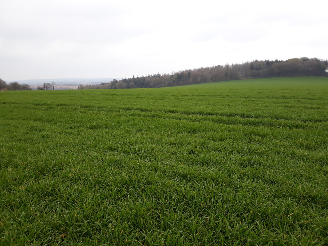 A typical example of a solar farm site Though no solar farms have gone to construction or operation as yet in Ireland, we do expect continued growth in this area. The programme for government includes a commitment to develop a Solar Energy Strategy that will incorporate commercial as well as private/residential solar projects. Rubicon’s experience in dealing with these projects means that we can help to pin-point the archaeological risks and take measures to quantify them prior to the submission of an application for planning, working collaboratively with the other disciplines in the design team. Knowing what to expect at this early stage in the project allows the design team to factor in archaeology and prevent any surprise effects on the project. 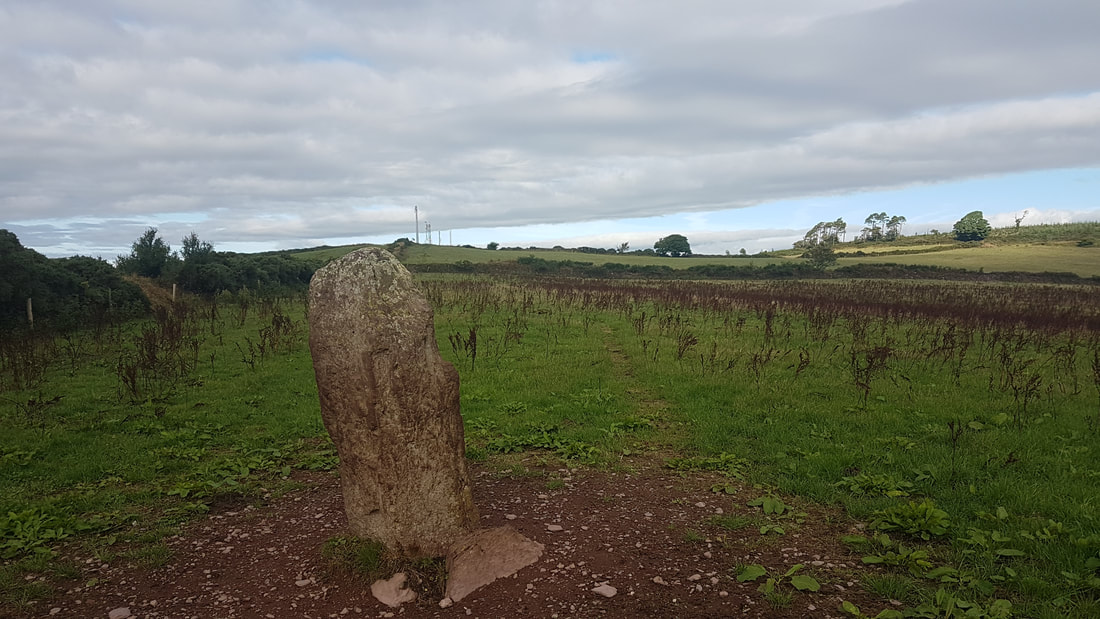 A standing stone from the walkover survey for a desk-based assessment Potential solar farm sites tend to be greenfield sites, often on south-facing slopes (to maximise solar exposure). However, this can be a favoured location for past settlement! This means that there is a potential for both known and often upstanding archaeological sites to be present as well as buried or sub-surface archaeological features. If not managed appropriately, such risks can have a significant impact on the project for a developer, affecting cost and programme and, in extreme situations the overall project viability, resulting in the abandonment of developments. 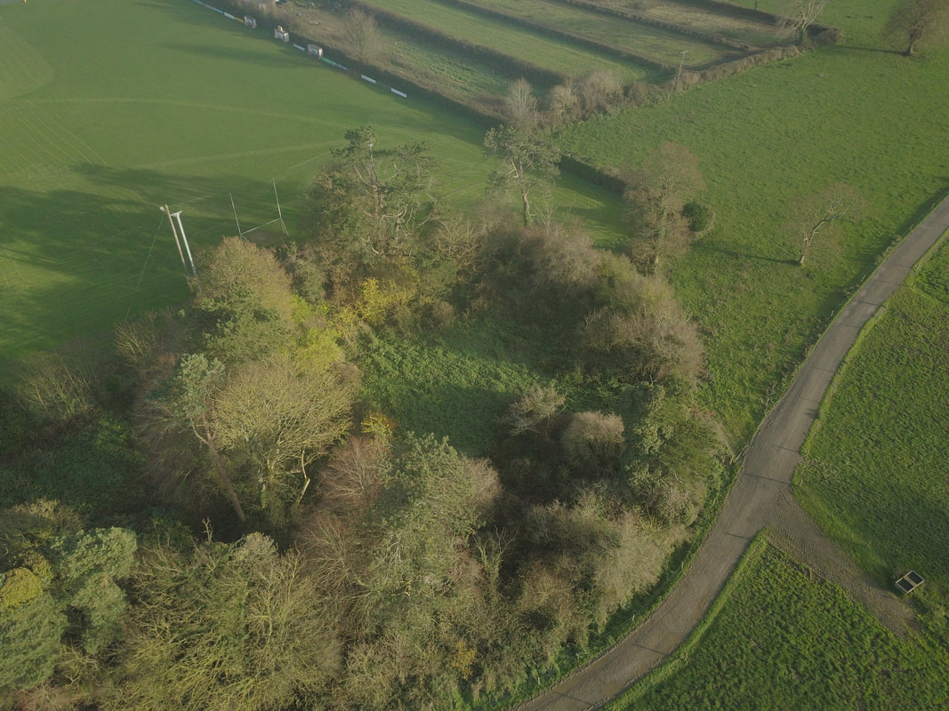 Aerial view of an upstanding ringfort site Rubicon works with our clients to focus on the early identification and avoidance of potential impacts to archaeology. This is effective in managing risk, which has obvious financial benefits. We recommend a staged approach, tailored to the needs of each specific project, incorporating:
Desk-based assessments involve a review of documentary sources including cartographic and aerial photo datasets to identify all known heritage assets and to highlight areas of high archaeological potential. We will work with the design team to identify measures to protect known heritage assets from impacts. We collaborate with the Landscape Consultants, in particular, to identify and manage potential visual impacts to the settings of heritage assets in the wider landscape.  Example of a typical constraints map from a desk-based assessment Geophysical survey and/or topographic survey are strongly advised, as early as possible, where the desk-based assessment has highlighted specific archaeological risks. Geophysical survey is a non-intrusive approach that can identify potential sub-surface archaeological features that are not visible above ground at all. This information allows us to develop appropriate mitigation strategies to minimise impacts and in particular to design-in buffer or exclusion zones that can protect these sub-surface features. Many local authorities will look for geophysical survey results to be included in planning submissions; and will request them as Further Information if not supplied. So, there is the further advantage that early survey can streamline the planning process and reduce the potential for delays in assessing an application. 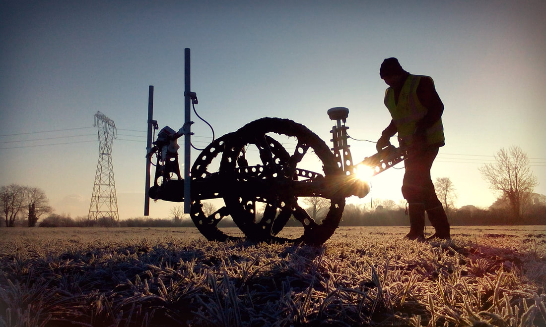 Geophysical survey can reveal sub-surface potential archaeological features Targeted archaeological test trenching can be undertaken to better understand the character and extent of potential archaeological features initially identified during desk-based assessment or geophysical survey. It can also be used to get more understanding of the risk in areas of high archaeological potential, where the development might require groundworks. This feeds into the further development of appropriate mitigation strategies and can allow for the full preservation in situ of an archaeological site (avoiding the delay and cost implications of a full archaeological excavation). 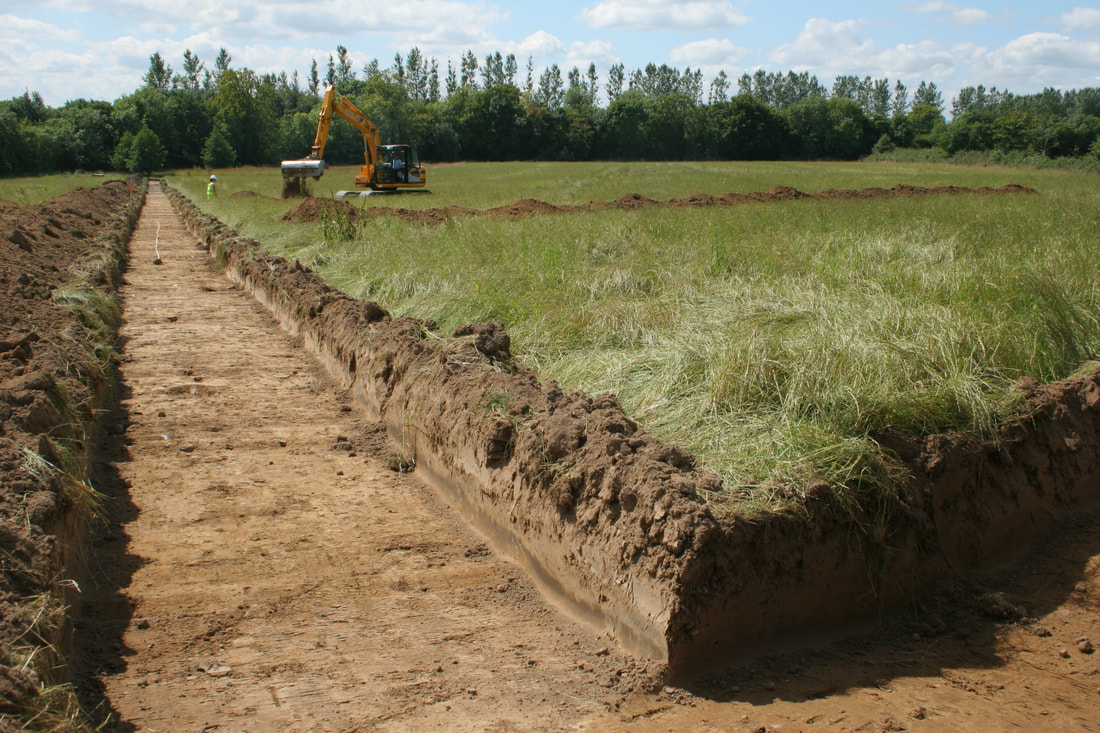 Test trenching allows us to understand the character of potential archaeological risks Further information about the services we offer can be found here: https://www.rubiconheritage.com/services.html
You can also contact us directly for advice on a specific project.
0 Comments
Your comment will be posted after it is approved.
Leave a Reply. |