|
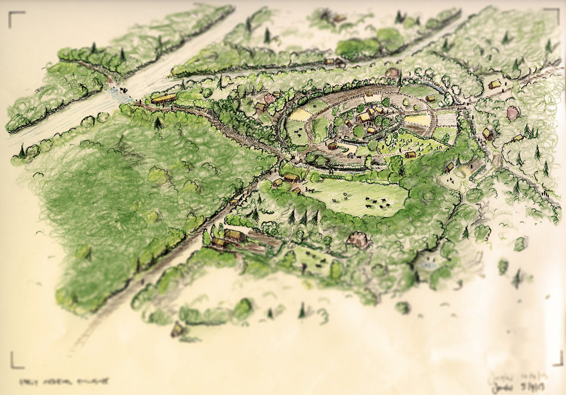
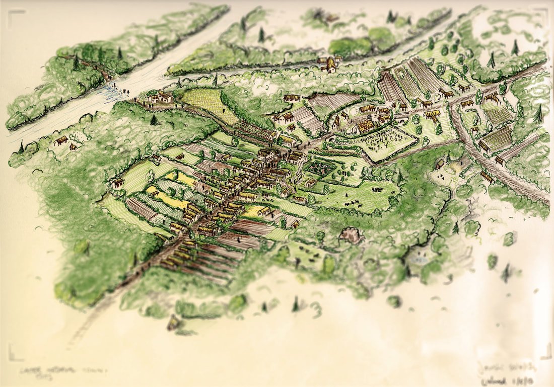
By Jonski (Jonathan Millar) A key goal of archaeology as an industry is making our findings accessible and relevant to the general public, and presenting the results of archaeological projects in ways that bring their story to life and highlight both the similarities and differences between the past and the present. 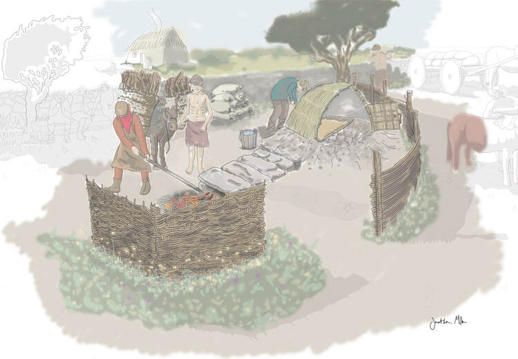 Corn Drying Kiln reconstruction, from the N17/N18 Gort to Tuam PPP Scheme, Co. Galway. I have prepared a 'work in progress video' of this piece, you can find a link to it below. 2014 Archaeological excavation and fieldwork is defined as ‘Preservation by Record’ – the controlled transformation of an archaeological site into a scientific, objective archive in accordance with various laws, statutes, guidelines and policy documents. To learn more about this side of our work you can watch a collection of videos we produced earlier this year on our YouTube channel. Large projects with significant archaeological remains can take months of fieldwork, involving dozens of archaeologists. The post-excavation analysis, interpretation and reporting often takes longer than the fieldwork and typically relies on the expertise of many specialists across a wide range of scientific disciplines. Dissemination of these archaeological stories is a huge part of what we do – most of the end products of our work fall into this category in one way or another - and the variety of ways archaeologists strive to achieve this goal is growing all the time. 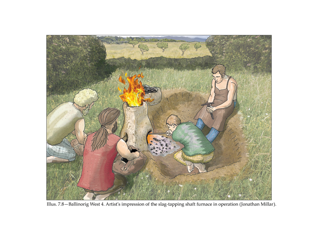 Reconstruction of slag-tapping shaft furnace from Ballinorig West, Tralee, excavated as part of the N22 Tralee Bypass, Co. Kerry. 2016 Journal articles, monographs, public lectures, ‘popular’ books, posters, websites, blog articles like this, podcasts and exhibition displays all tend to have one thing in common – the pictures are often the most accessible bit and quickly convey complex ideas that might indeed take 1000 words to tell otherwise. Archaeological Reconstruction After the location maps, site plans, section profiles, photography and artefact drawings have been created, the very last illustration to be undertaken for a completed project is usually a ‘reconstruction’. 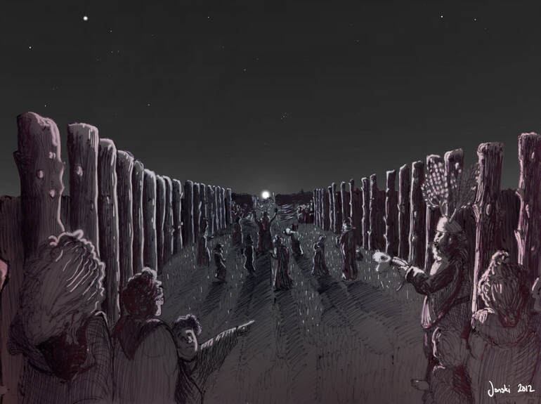 That time when I was allowed to go completely off-piste with a visualisation of a Bronze Age Moonrise Ceremony at Ballingowan, Tralee. We used software to show exactly what the night sky would have looked like at the time of our C14 dates as the post hole avenue wasn't pointing at the sun. 2012 Archaeological reconstruction illustrations strive to present a plausible snapshot of life-in-progress, taking the viewer across time to a specific moment, presenting the collated scientific evidence of technology and humanity in an aesthetic manner, encouraging empathy, engagement and understanding in the viewer.
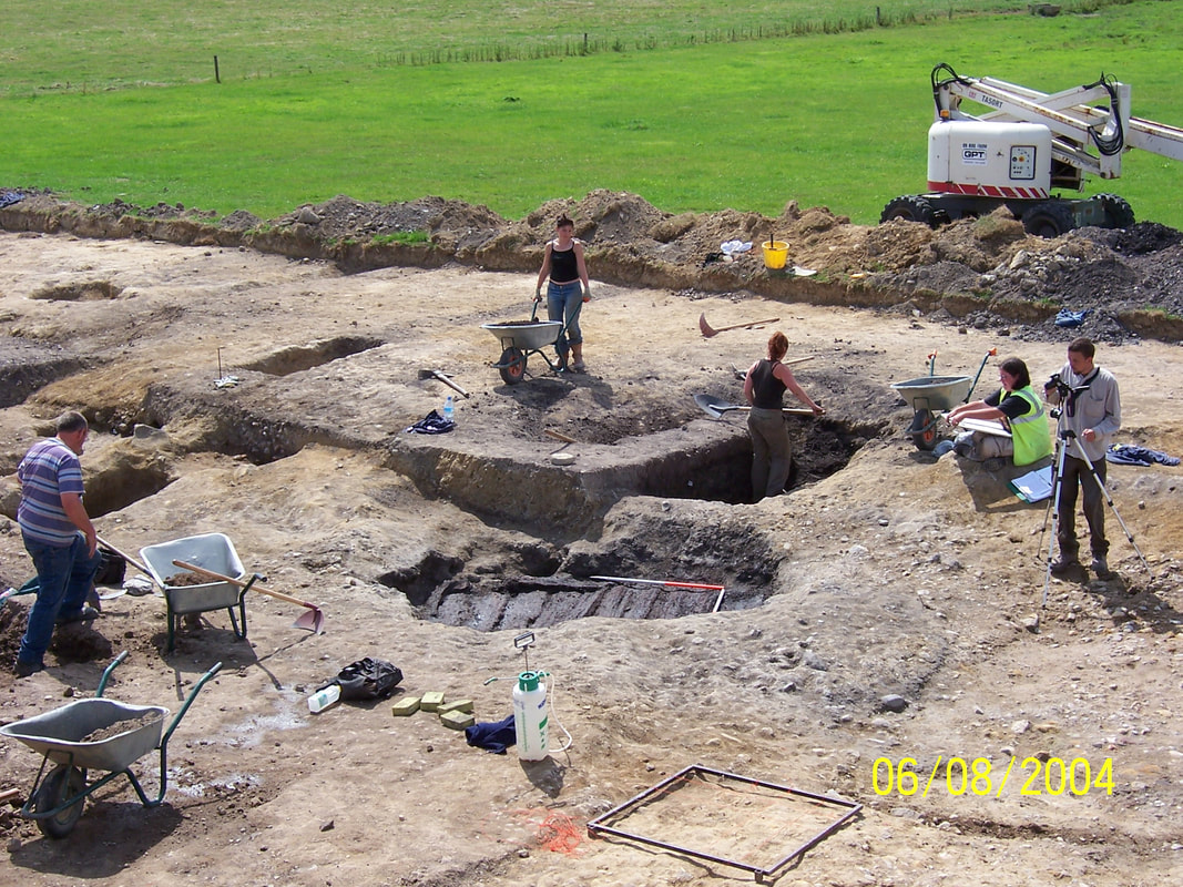
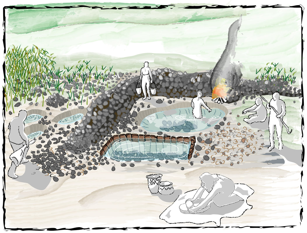
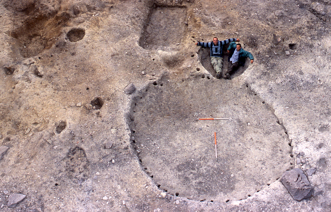
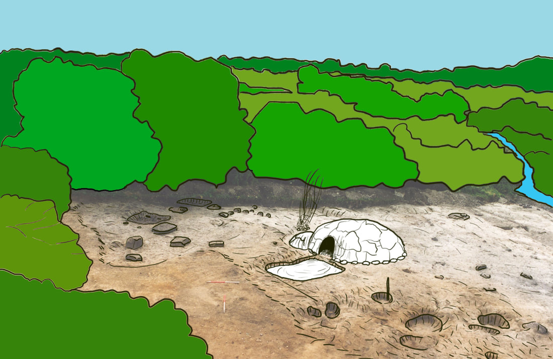
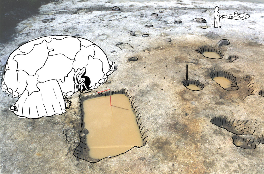
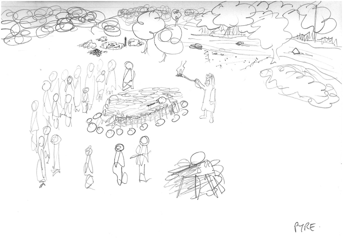
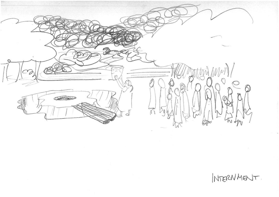
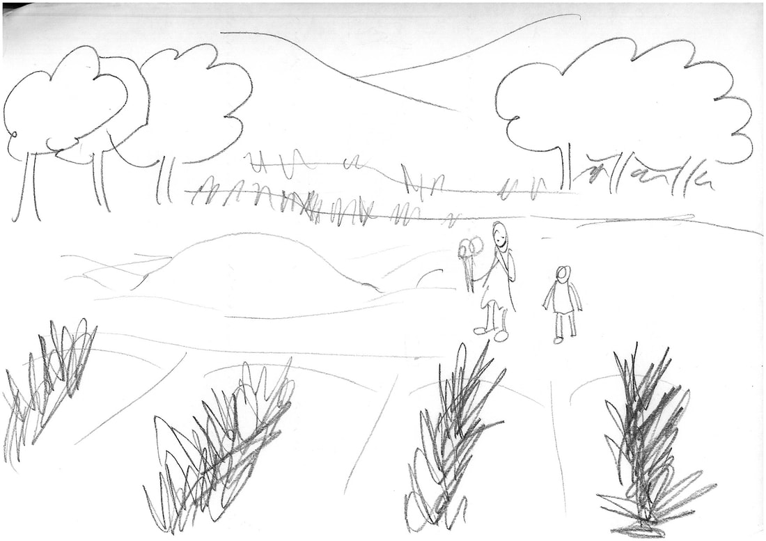
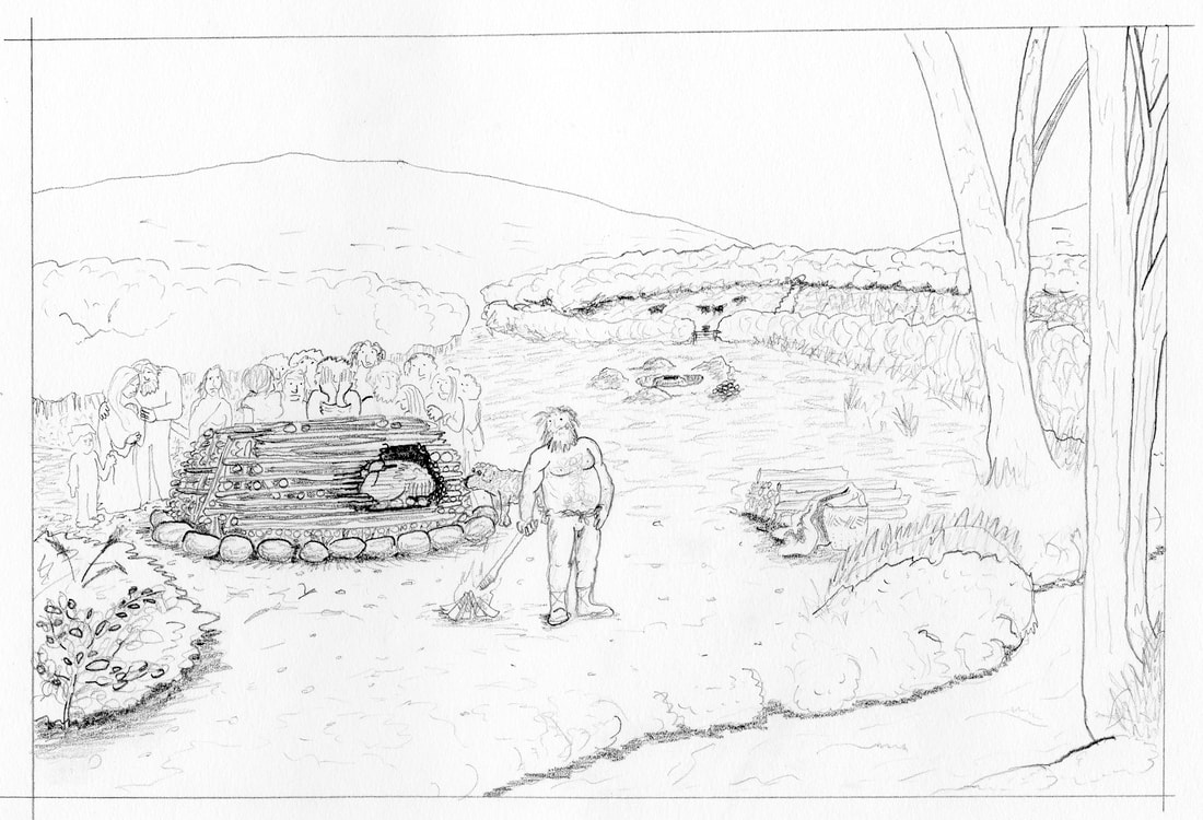
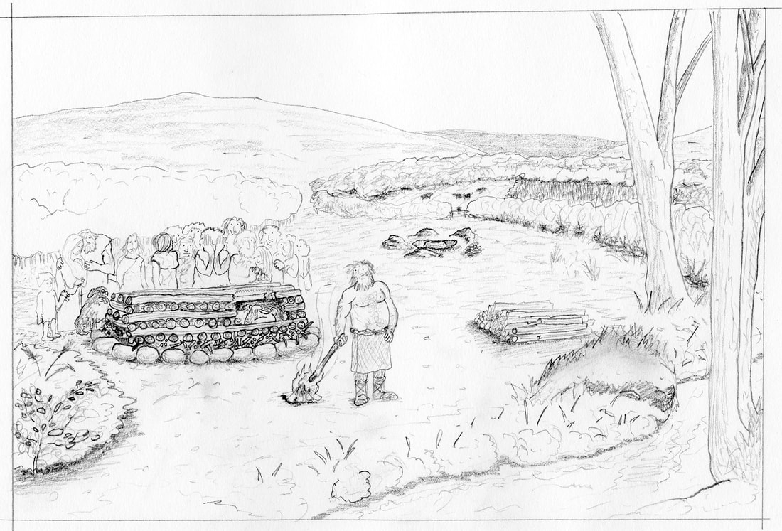
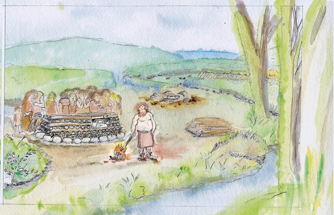
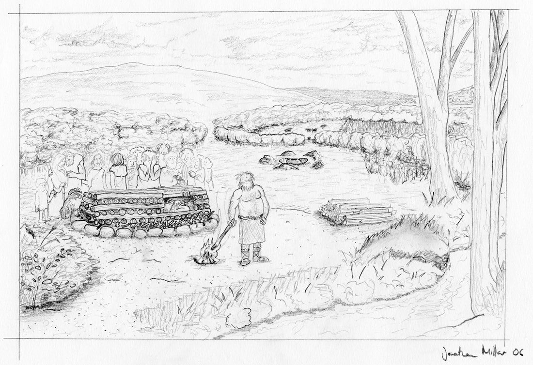
The biggest challenge in recreating the past like this is ‘filling in the blanks’ – archaeologists never get a complete picture – it is often very fragmentary - so we have to infer knowledge from parallel or similar sites and the results of experimental archaeology, working together to build something like a jigsaw, piece by piece. Unique sites like Pompei, the Must Farm Project or Otzi the Ice Man where catastrophic events ironically preserve fascinating aspects of life and death ‘frozen in time’ often raise more questions than they answer. However, they give us bench-marks to work from and typically show us that our ancient ancestors were more like us than we had previously been able to prove. We learn they had the same drives and needs, had fascinating skills, often developed technologies earlier than we knew and enjoyed more comforts (and hardships) than we would have imagined possible. Everyone alive is here today because our ancestors prevailed over adversity and fate - we share much more than the small things that make us ‘different’ from each other. 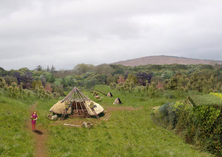 Early medieval round house reconstruction, from the N22 Tralee Bypass, Co. Kerry, undertaken in Adobe Photoshop. I have prepared a 'work in progress video' of this piece, you can find a link to it below. 2016 All studied sites add something to our understanding, and by gradually collating pieces of our shared story and recognising what is the significant information to be gleaned from each site, we move forwards in our collective understanding of each ‘Age’ and see the connections between past peoples that cross seas and cultures, link distant locations and help to colour-in our world view, redefining our own positions within it. Personal experienceIn my own work I thoroughly enjoy producing reconstruction illustrations. I like to use a variety of techniques and materials but the majority of my final work is digital in origin, using Adobe Creative Cloud software. Digital artwork gives greater flexibility for reproduction and allows for ongoing editing, adjustment and collaboration. Initial sketches are usually done in pencil on paper but digital mock-ups using internet resources and imagery is a useful technique too. I experiment as much as is practical and like to try new things. Here are a couple of examples showing the process of development of a reconstruction: I often utilize on site photography taken during fieldwork or from my own site visits to form the basis of my reconstruction illustrations. I visualize back in the layers that time has removed, using the environmental evidence from our soil samples and analysis to show how the flora and landscape could have looked, adding native tree species and vegetation based on pollen analysis. I use the archaeological record we have built up as well as research into similar sites to develop the contents of each illustration. 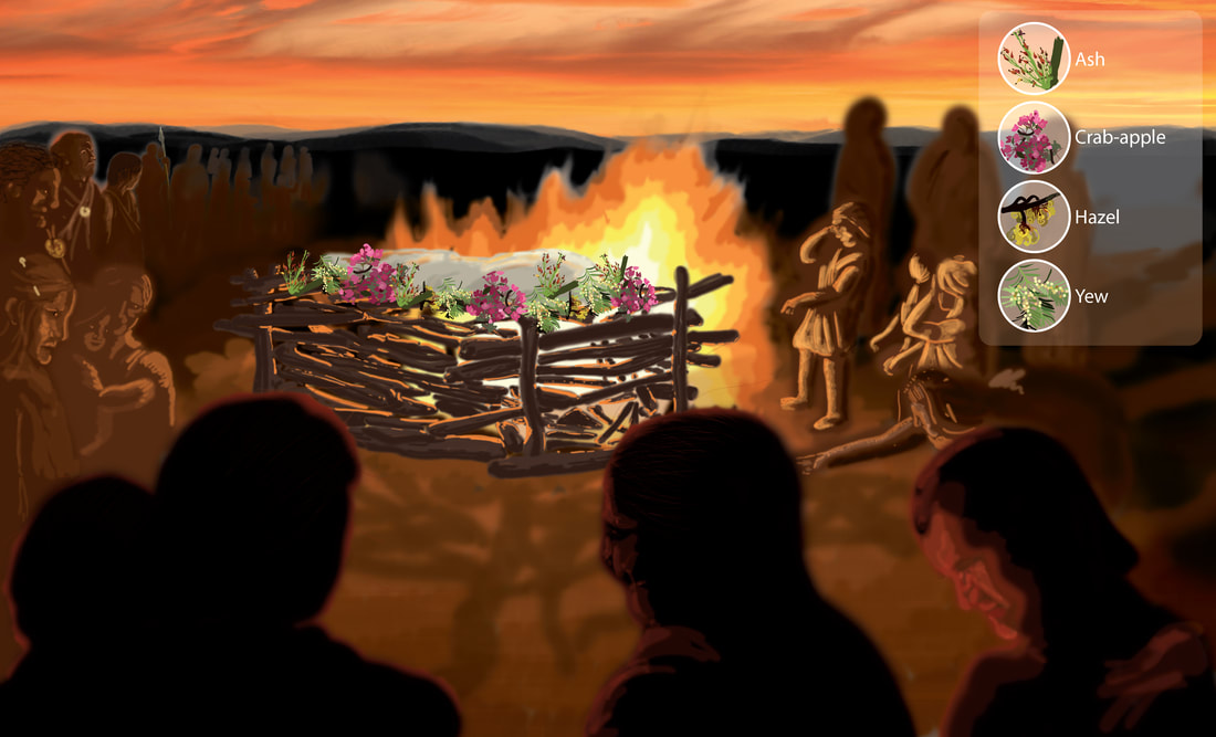 Imagining of a funeral pyre ceremony. Pollen and wood samples recovered from the environmental samples showed a variety of flowering indigenous species were present in the pyre during cremation. The reconstruction explores whether they could have had an aesthetic as well as functional purpose. 2014 I especially enjoy working with photos where archaeologists are performing tasks of excavation and recording. Besides adding a relevant scale, the poses and activities of fieldwork are often well suited to ancient sites and can influence the direction a drawing adopts, it’s also satisfying to ‘immortalize’ colleagues into an artwork!
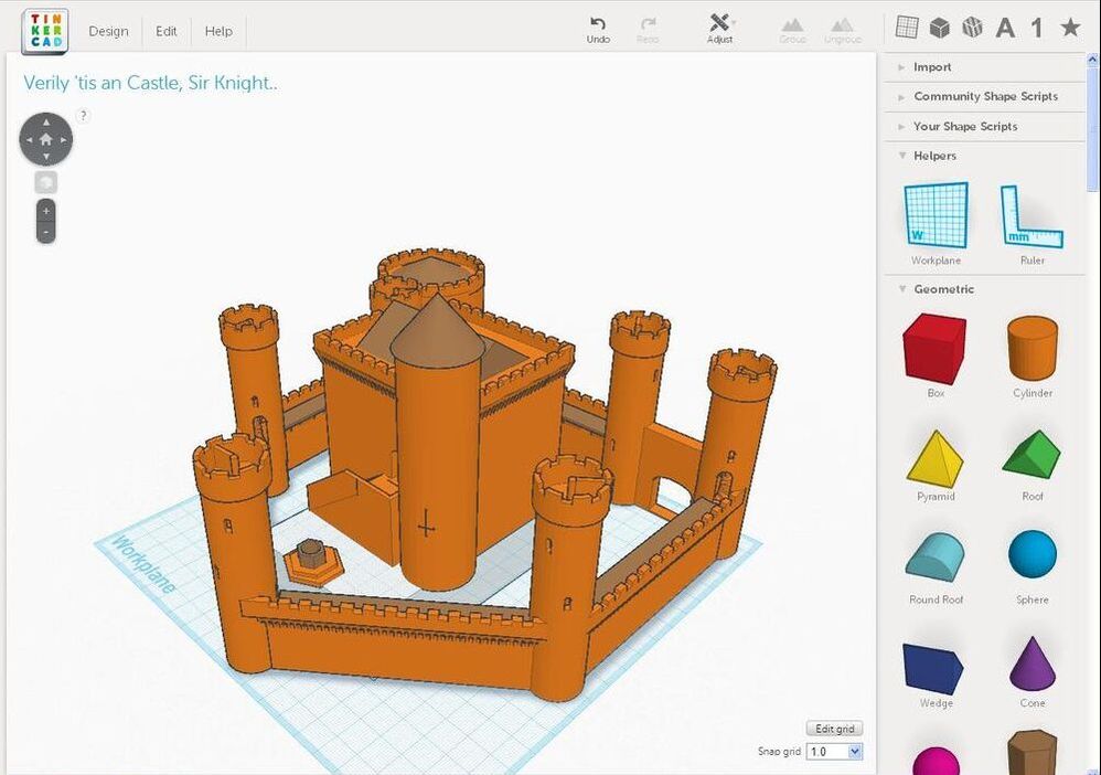
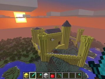
Where appropriate and relevant, we have arranged site photos with people deliberately holding poses of perceived activities associated with our sites, reconstructing structures or features around them, adding animals for which we found evidence or artefacts that were uncovered during excavations. Thus an archaeologist excavating a feature with her trowel may become a Bronze Age woman cleaning a hide with a flint scraper. I often photograph colleagues or myself in required stances to populate illustrations too. I usually keep costume vague (in the absence of direct evidence), but am influenced for colours by the natural dyes that would have been available in the relevant period, and styles based on textile research and museum examples of contemporary sites if it exists. As soon as my artwork is released ‘into the wild’ it takes on a life of its own - drawings I believed to be mediocre can be requested to be used again and again and ones that were fit for purpose at the time can age badly or be proven to interpret results incorrectly. This is a result of pushing boundaries using knowledge supported by imagination! The production process of creating reconstruction drawings is always a team effort, with discussion, review and adjustment at every stage. Ultimate reality of whether an illustration achieves the goals I outlined earlier is shared between that artwork and its audience – a relationship which is unpredictable and can change over time. Follow upIf you have an interest in archaeological illustration or creating pictures to tell a story, there are lots of free pieces of software you can use to practice and experiment. Inkscape is a free-to-use vector illustration package very similar to Adobe Illustrator and Gimp is an open-source raster (pixel-based) image editing package, similar to Photoshop. There are a variety of similar useful packages to get started with 3D model making, including Tinkercad and Sketchup. Besides creating unique artworks, you can export models from Tinkercad and import them directly into Minecraft using Minecraft Editor*, then walk around and explore what you have made. So far I’ve only played with this as a means of presenting archaeological results - we’ve yet to find a suitable application for it in a professional context, but they are great fun and accessible and will help to encourage future generations of archaeologists and disseminators.
*To use Tinkercad/MCEdit with Minecraft, you will need to play using Java Edition release 1.11 or earlier, or Forge 1.7 as MCEdit does not support later editions (or Bedrock).
0 Comments
Your comment will be posted after it is approved.
Leave a Reply. |